Ice Age Trail Alliance protects two strategic properties for future Trail.

The Ice Age Trail Alliance permanently protected two strategically located properties in Waupaca and Manitowoc Counties for future Ice Age National Scenic Trail. The Alliance officially acquired both properties on March 21, using its own funding.
Offering a premier outdoor hiking experience, the 1,200-mile Ice Age Trail exists to protect and highlight glacial features and landscapes left behind by the last continental glacier.
In addition, the linear nature of the Trail provides an amazing opportunity to orchestrate restoration efforts along a corridor, providing a connected and healthy habitat for native species up and down the food chain.

Adjacent to a State Natural Area:
The 28-acre parcel located in the Town of Scandinavia will permanently protect more than a ¼ mile of future Ice Age Trail in Waupaca County.
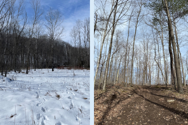
Tucked between Skunk and Foster Lakes State Natural Area—land owned by the Wisconsin Department of Natural Resources—and County Highway V, the acquisition creates a better road-to-road connection for the Trail. Plus, since it is adjacent to public land, the purchase increases the acreage available for recreation and ecological restoration. Hikers especially will enjoy the property’s varied terrain: wetlands, mixed hardwood forest, and rolling glacial topography.
“The parcel also preserves more than 1,200 feet along the banks of Sannes Creek, a trout stream running through the property,” says Kevin Thusius, Director of Land Conservation for the Alliance. “Protecting the stream and adjacent 11 acres of wetlands is essential for keeping the creek crystal clear.”


The former landowners are excited about their former property hosting future Trail.
“We hope you build the Trail soon. Currently, we have to walk the roads around to access the Trail. When you build this new section, we will be able to walk right from our home,” said Howard and Petra Inderdahl.

Additional Acres Close a Gap:
The recently acquired 60 acres, located in the Town of Schleswig, will permanently protect more than ¾ mile of future Ice Age Trail in Manitowoc County.
The property increases the size of the Alliance’s Brownrigg-Heier Preserve to 316 acres. It also closes a gap by connecting the Preserve to Manitowoc County Park property which hosts the 2.3-mile Walla Hi Segment of the Ice Age Trail.
“Our map for this area used to look a lot like a checkerboard, but over time, it has become much more unified,” says Thusius. “Now, these uninterrupted acres can benefit from a cohesive management plan that promotes healthy habitats for native plant and animal species.”


This land was important to protect, not only because of its location but because it is a great example of glacial geology. “This Walla-Hi area represents one of the northernmost pieces of Kettle Moraine topography, which means steep, rolling hills and dry kettles sticking up from mostly flat terrain,” says Thusius.
With the additional property, there is a real opportunity to create a brand-new, 2.5-mile section of Ice Age Trail and connect it to existing Trail in Walla Hi County Park. New blazed hiking Trail would reduce the amount of road walking between segments (called connector routes); currently, more than 40 of the 72 miles of Ice Age Trail in the county are on connector routes.
The Alliance has yet to open either property to the public. They await boundary markings, and the Ice Age Trail route must be created and blazed. New Trail will be announced in the future.
Protecting Land is the First Step to Completing the Ice Age Trail
Once the Alliance protects land, it develops a management plan, which determines property uses and future developments (such as trail and camping locations). While planning is underway, state and federal reviews take place. Once approvals are received, construction can begin on the Trail and parking lots, boundaries are marked, and signage is put up.
The Ice Age Trail Alliance continuously seeks opportunities to protect land within the up-to-three-mile-wide corridor identified by the National Park Service as the route for the National Scenic Trail. Currently, 698 miles of the nearly 1,200-mile Trail is blazed hiking trail, ready for use. The remainder of the route follows rural highways and backroads (connector routes).
In the future, the Alliance may seek reimbursement for the property from the State’s Knowles-Nelson Stewardship Fund or by selling it to the National Park Service.

