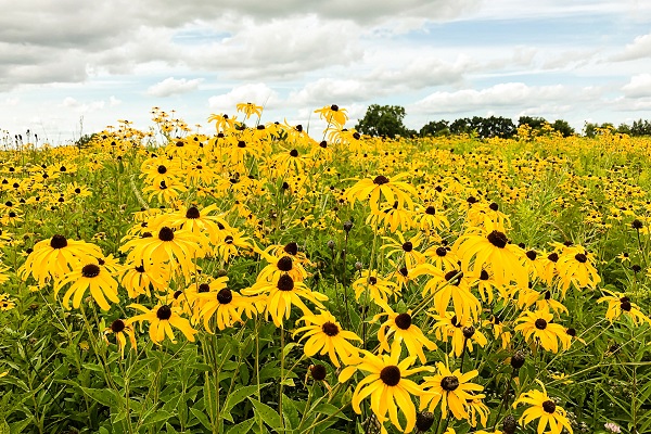
Strung like pearls along the Ice Age National Scenic Trail’s winding route are both beautiful and geologically significant properties owned by the Ice Age Trail Alliance. Take, for example, the Marimor Preserve, in Taylor County, known for hosting one of the state’s finest examples of a terminal moraine. Another is the Moraine-Outwash Preserve in Langlade County – it offers spectacular views across the Antigo Flats and illustrates its name-sake glacial feature. And then, the Muir Preserve, in Marquette County, which protects the area surrounding John Muir’s boyhood homestead, allowing Wisconsinites better to appreciate the land’s hold and influence on Muir.
Another commonality among these properties? The Alliance purchased them using matching grant funds awarded from Wisconsin’s Knowles-Nelson Stewardship Program.

For the last 30 years, the Ice Age Trail Alliance has used Knowles-Nelson Stewardship Program funds for purchasing land for the Ice Age Trail. Each acquisition will now, or in the future, provide a home for new Trail miles. Simultaneously, each purchase protects renowned glacial features, important historical sites, and vital wildlife habitat that includes mature forests, beautiful wetlands, rushing streams, and remnant prairies.
Over the years, the Knowles-Nelson Stewardship Program has been the solid footing beneath a radically improved hiker experience. One where natural beauty nourishes the hiker’s soul and geological wonders inspire the mind.
For Trail enthusiasts, the Knowles-Nelson Stewardship Program funds’ far-reaching benefits can be experienced across 11 counties – Polk, Chippewa, Taylor, Langlade, Marathon, Marquette, Columbia, Dane, Waukesha, Washington, and Sheboygan – where the Alliance owns and manages more than 50 properties.
View this interactive map to view the impact of Knowles-Nelson Stewardship Program funds across the state.
Highlights - Remarkable Properties, Acquired Since 2014:
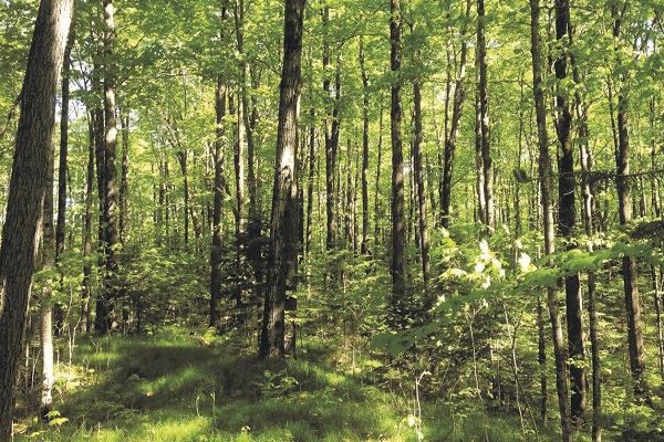

The Rib Lake Segment, Marimor Preserve, Taylor County
The Alliance saved a historical landscape and threatened hiker viewshed with the purchase of this 156-acre tract. Notably, the Wisconsin Valley Lobe of the most recent glacier created the property’s terrain, which features a terminal moraine – a ridge of gravel and boulders that shows the glacier’s furthest reach.
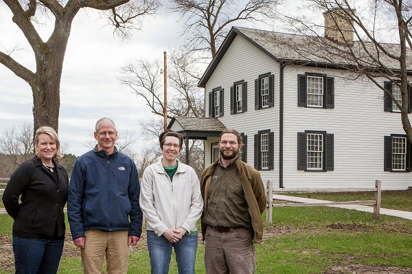
The Portage Canal Segment, Canal Preserve, Northern Columbia County
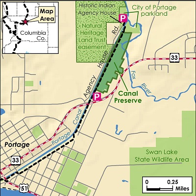
A purchase of 46 acres on the south side of the Portage Canal, permanently protected a Trail segment. It was also part of a more extensive partnership to preserve the Historic Indian Agency House’s natural areas.


Rice Lake Preserve, Marathon County
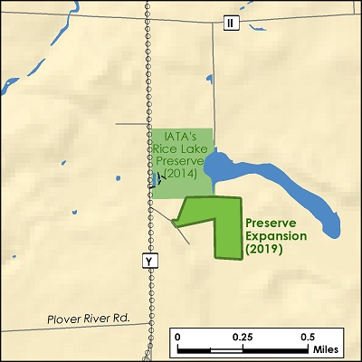
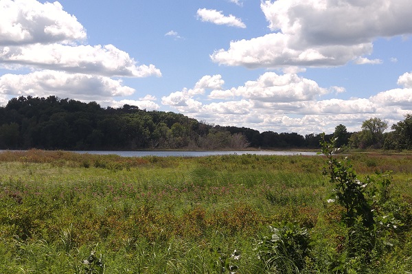
In 2014, the Alliance purchased 41 acres in the Town of Reid with an eye towards it hosting an Ice Age Trail section one day. The land includes 1,000 feet of shoreline on Rice Lake, a spring-fed, undeveloped marl lake. White cedar forest covers the majority of the property’s acreage.
In 2019, a new 22.7-acre acquisition will eventually allow for a road-to-road connection for future Trail. It also boasts a high ridge flanking the banks of Rice Lake Creek and acres of beautiful, upland, wetland forest.


Moraine-Outwash Preserve, Langlade County
The Alliance acquired this 39-acre property as an “anchor” for future Ice Age Trail development. It is a spectacular piece of land from a geological perspective: it provides a great view across the Antigo Flats, which are large, flat, relatively open areas of land in the shadow of the surrounding moraines. Remarkably, the flats can even be seen from outer space (see image to the left).
The John Muir Park Segment, Muir Preserve, Marquette County
In 1849, when John Muir was 10-years old, his father Daniel purchased a 320-acre farm. In 2015, the Alliance joined a historic effort with numerous non-profits, land trusts, and conservation organizations to help protect 290 acres of the original homestead. The Alliance is taking an active role in transforming 78 acres of agricultural fields to prairie and woodlands.
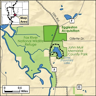

In 2018, private donors stepped up to match Knowles-Nelson Stewardship Program funding. As a result, they increased the Muir Preserve size by another 50 acres along with a 40-acre trail easement. The land consists of mature oak forest, beautiful wetlands, small fields, a quiet stream, and a remnant prairie.
The Cross Plains Segment, Mammoth’s Back Preserve, Dane County
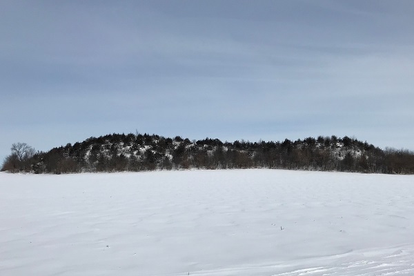
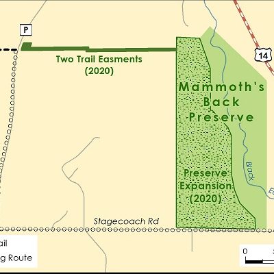
Just outside of the Village of Cross Plains is a newly minted 81-acre preserve with an iconic shape. The distinct ridge-line on the property is reminiscent of a woolly mammoth’s double-mounded back, which inspired the Preserve’s name. The Alliance is busy restoring the land, including an ecologically significantly remnant hilltop prairie.
The Knowles-Nelson Stewardship Program is due to expire in 2021!
Lawmakers in both Wisconsin State Assembly and Wisconsin State Senate need to vote “YES” to renew the Knowles-Nelson Stewardship Program, or this important source of state funding will be gone. Without this matching grant program, it will be harder to protect Wisconsin’s land, water, wildlife, and way of life.
What is the Knowles-Nelson Stewardship Program?
The Knowles-Nelson Stewardship Program, created in 1989, is a vital source of state matching funds used by local nonprofit organizations to protect land and water in Wisconsin. Stewardship grants are used to:
- Protect our water resources and air quality
- Provide wildlife habitat
- Support jobs and local economies
- Promote outdoor recreation
Landowners, land trusts, and communities use Stewardship grants to protect the special places that make Wisconsin a great place to live, work, and play.
