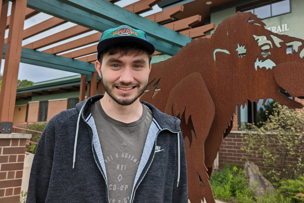
We are excited to have Jack Sagers on the Alliance team as our GIS Intern.
For about a year, Jack has been working behind the scenes on various GIS (geographic information systems) projects. He is a rising junior at UW-Madison and is majoring in Cartography/GIS and Geography with a focus on people and the environment.
Jack’s connection to the Trail goes back to his childhood, specifically an elementary school teacher. His third grade and fourth grade teacher was Luke Kloberdanz, who is now the Director of Philanthropy at the Alliance. You could call it coincidence or fate that Jack now finds himself interning at the Alliance: “I ran into Luke Kloberdanz on the Trail… and then because he was my former elementary school teacher we chatted, he asked what I was up to, and I said what I was studying. He said we [the Alliance] might have a position or internship available.”
GIS is a software program and database for analyzing and visually representing geographic information. The Ice Age Trail Alliance uses GIS to develop maps that hikers rely on to orient themselves on the Trail. GIS maps provide vital information about land ownership, parking, camping, terrain, and distance. These maps are continuously updated.
During his time at the Alliance, Jack has worked on a variety of GIS maps, aiming to improve online and map resources available to hikers. Last summer, Jack developed a series of ‘You Are Here’ maps to orient hikers at Segment trailheads. He also worked on story maps, which are essentially virtual tours of the Trail that allow hikers to learn about various segments and plan future hikes throughout the state. This summer, he’s helping update GIS maps for upcoming revisions of the guidebook and atlas.
GIS is an interesting merger of technology and the outdoors. Jack said there’s a limit for how long he can be in front of a computer, but he never gets tired of being outdoors. Being from Lodi, Jack has explored a lot of the Trail. But his favorite segment is the Mecan River: “I’m not sure why I like it. It’s kind of flat but it’s also got some rolling hills areas. I think it’s the vegetation. It’s not what I’ve perceived Wisconsin ever having, growing up here, it’s different.”
Jack loves improving hiker resources with GIS. A special perk of the job is when he gets to participate in events and meet the volunteers and hikers who will benefit from his work. He also looks forward to exploring the outdoors beyond Wisconsin. This summer he is going on a backpacking trip to Durango, Colorado.
We look forward to working with Jack to conserve, create, maintain, and promote the Ice Age Trail!

