The Ice Age National Scenic Trail traverses over 1000 miles of forestlands, prairies, wetlands, and roadways throughout Wisconsin. Many of these paths are made possible by partnerships with private landowners and lands owned and managed by municipal, county, state and federal agencies. As such, hikers must be mindful of a regulations on property types, hunting seasons, and trail signage while hiking the Ice Age Trail, especially when crossing private lands. Guidelines for hiking through private lands are found below.
Finding Property Closures
Online interactive maps are instrumental resources for Ice Age Trail users to plan their hiking trips. The Trail Alerts Dashboard and Hiker Resource Map are available on our website.
The Trail Alerts Dashboard notifies hikers of current trail closures and trail conditions. Click on the yellow alert icons to learn more about the trail closure. Trail condition updates can be sent in by the public to notify Ice Age Trail Alliance staff about recent trail damage.
The interactive, online Hiker Resource Map offers in-depth information on trail segments, parking areas, camping options, and trail alerts. You can adjust the zoom, view the map legend, and add and remove map layers to explore the interactive map.
Crossing Private Land
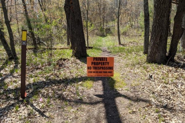
Certain sections of the Ice Age Trail traverse private land. In these cases, landowners have allowed hikers to cross their land in clearly marked trail corridors. Yellow blazes are the official indicator used to mark the Trail route. The yellow blazes are seen as bright yellow painted or plastic 2-by-6-inch vertical rectangles placed on trees and posts along the Trail.
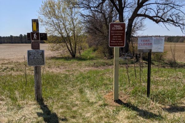
Please be aware of signs denoting private land or trail closures. Do not bypass “Trail Closed” signs to hike the damaged or closed off sections of the Trail on private land. Doing so jeopardizes the long-term goal of reopening the Trail by negatively affecting relationships with the landowners in these areas.

Sticking to the Trail corridor is a general recommendation for the entire Ice Age Trail but a requirement on private lands.
Property Closures During Hunting Seasons
The Ice Age Trail passes through many lands open to hunting, and as such, hikers are likely to see their hiking options become limited during the deer, turkey, and waterfowl seasons. This is especially true at the end of November during the annual nine-day gun deer season. For your safety, consider November through March “Blaze Orange Season” and wear blaze orange or other bright colors when you and your pet are on the Trail.
You can find the most updated information on hunting season dates in Wisconsin here.

Hunting on Private Lands
Private landowners who generously host portions of the Ice Age Trail may close off the portions of the trail that runs through their property during hunting seasons. Watch for “Trail Closed” signs and online updates. Respecting these segment closings ensure continued good relations with private landowners.
Hunting on Public Lands
Hunting is allowed in most state parks and State Ice Age Trial Areas from Nov. 15 to Dec. 15 and April 1 to early May. During these hunting periods, just about all of the segments on public lands are open for hiking, including the Chequamegon-Nicolet National Forest, state and county forests, and state parks.
Thank you for respecting Trail closures and helping us honor our agreements with public and private landowners!


