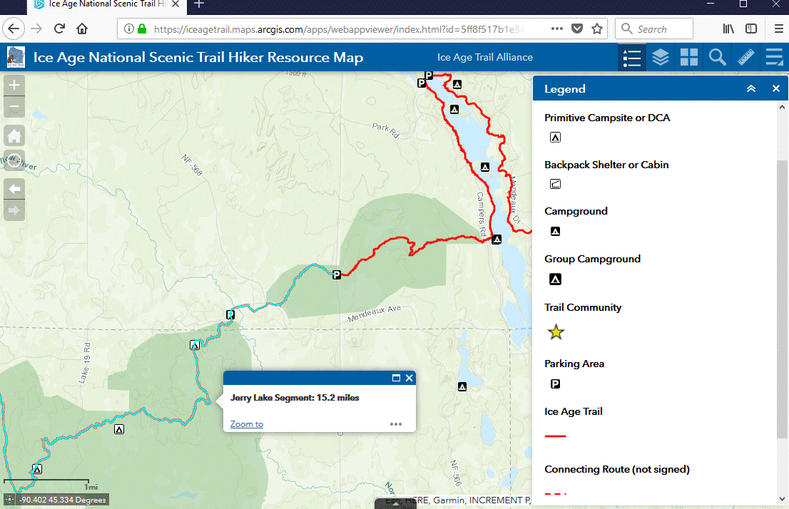
Clicking on a feature in the map will bring up more information, such as the name and length of an IAT segment.
The NEW interactive Hiker Resource Map shows all official Ice Age National Scenic Trail segments and (unsigned) connecting routes, and additional features such as camping, parking, water, ColdCache sites, and Ice Age Trail Communities. The map works on computers and mobile devices.
We like how intuitive it is. Hover over an icon to gain more information. Click on the options offered on the toolbar (see above example) to expand the information available. Continue reading